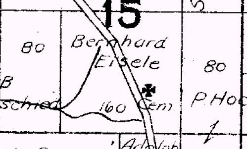
A plat is a map that is drawn to scale and shows land divisions. Maps are resources that are often overlooked, but can be invaluable when searching for land owning ancestors. County and city plats usually look something like this image taken from Tazewell County Map Company, East Peoria IL, 1921, 48 pp:
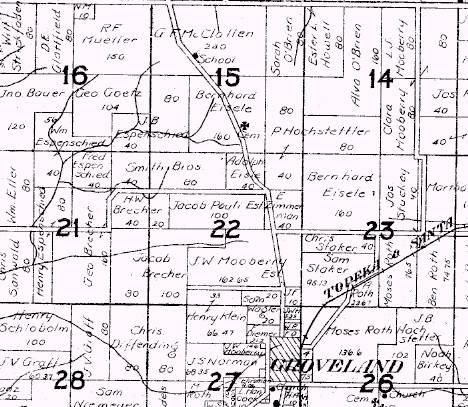
If you look closely, you will see that the information recorded on the map includes the names of each property owner:
All counties have land plats, but to gain access to them you have to know where to look. In some areas the county Archives or Local History room in your local library will have various plat books and maps. Sometimes researchers must travel to a local historical society library or courthouse to gain access to plat maps. Start by talking with a librarian or reference person at your local public library. These folks can be of great help when getting started with any type of research project. If library staff cannot point you in the right direction, speak with a representative from your local historical or genealogical society. Chances are these individuals have experience researching history and genealogy in your location. If the above options do not generate good leads try contacting your local courthouse or city planner. Someone will be able to grant access to these records or can tell you where to find them. Happy searching!
No comments:
Post a Comment